By AGRC Dev Team on Jan 17, 2014
New Utah Geocoding Toolbox for ArcGIS Desktop
This article will take 2 minutes to read
This tool has been updated to work with ArcGIS Pro. Some of the information below may be outdated. Please refer to GitHub for the most current documentation.
AGRC is proud to announce the release of a Utah-specific geocoding toolbox for ArcGIS Desktop.
This custom geocoding toolbox allows ArcGIS users to obtain geographic coordinates from AGRC’s Web API geocoding endpoint for any table of addresses in an ArcGIS accessible format.
While the geocoding endpoint was built primarily for web applications it also provides value as a toolbox in ArcGIS, as it uses current local data and solves for some common shortcomings with stock geocoding approaches by:
- using hierarchical street name and address coordinate system aliasing
- use of either zip codes or place names as zones
- ignores placename and zip code errors within the same addressing system
- handles common placename usage and abbreviations (WVC, St George, Magna, Heber City, S Jordan, etc.)
- can find matches for numeric address ‘reversals’ (500 E 1991 S)
- can find address point matches, offset centerline matches, or best available.
- more information
Use the Street and Zone endpoint on the API Explorer or the Find Address widget on atlas.utah.gov to test the results from your problem addresses against the API.
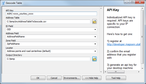
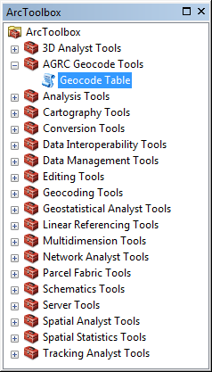
Installation is as easy as downloading the AGRC Geocode Tools.tbx file to your desired location and then in ArcGIS, right clicking the Add Toolbox menu item.
Users must obtain an IP specific API key by registering prior to use, as a unique API key is one of the required input parameters for running the tool.
The geocoding tool will produce as output a .csv file with the input unique identifier field, the input address information, and the match results. It also produces a .dbf file with the same information and will provide the user with the option to add this to the current ArcMap project. A user can use the .dbf file to join on the unique record identifier to connect with the original results, and also to Display XYEvents to create a map layer of the results.
Users can view/edit the python code associated with the geocoding toolbox by right clicking on the script and selecting ‘Edit’.