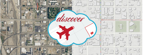
Discover — Our Imagery and Base Map Server
About Discover
Discover is a cloud-based server that provides AGRC's aerial imagery and base maps to anyone who wants to use them in their GIS, CAD, or web applications. Discover delivers its services in both WMTS and WMS formats from the Open Geospatial Consortium (OGC) for broad compatibility. Like other common web map services, they are provided in the Web Mercator WGS84 projection (wkid/EPSG 3857).
You will need to register for a free Discover account to access these services. There are two levels of Discover access:
- General access, for anyone who wants to use our base maps, NAIP imagery, or HRO imagery.
- Licensed access, for Utah's cities, counties, special districts, state agencies, K-12 school districts, colleges, universities, and tribal entities (or contractors or formal partners of any of these entities). This provides access to statewide high-resolution aerial imagery under the state's Google and Hexagon imagery licenses in addition to the general base maps and imagery. Visit the license information page for more details.
Anyone can use the general access imagery and base map services from Discover! To use these services, all you need is a free account and its corresponding quad-word connection link.
Sign Up
Choose the Right Form
You must choose. But choose wisely, for as the true form will bring you maps, the false form will take them from you.
     — The Grail Knight (probably)
To register a Discover account, fill out the appropriate form:
- Discover Server Access Form, for general access.
- Organizational Usage Agreement Form, for licensed access by one of Utah’s cities, counties, special districts, state agencies, school districts, colleges, universities, or tribal entities, or a contractor or formal partner of one of these organizations. Students in the state of Utah working on school projects also qualify for licensed access.
Students: Please use the Organizational Usage Agreement Form (except for students at out-of-state schools) and provide a school-supplied e-mail if possible.
Once you have completed the appropriate form (please only fill out one or the other, not both), we will review your request, create your account, and send you an e-mail with information about the services.
Get Connected
Your account e-mail will contain URLs that you'll enter into your software or web application to access the WMS, WMTS, or tile services. They contain a quad-word (e.g., https://discover.agrc.utah.gov/login/path/your-unique-quad-word/) that is unique to your user and should not be shared with anyone outside your immediate organization. Multiple requests from the same organization may be given the same quad-word.
- WMS:
https://discover.agrc.utah.gov/login/path/{quad-word}/wms - WMTS:
https://discover.agrc.utah.gov/login/path/{quad-word}/wmts/1.0.0/WMTSCapabilities.xml - Tiles:
https://discover.agrc.utah.gov/login/path/{quad-word}/tiles/{service}/{z}/{x}/{y}
For best performance, we recommend using WMTS when possible. WMS is slower and has technical limitations that could prevent the layer from drawing when exporting or printing maps.
Be sure to visit our Discover Server Resources and Information page to learn more about using the Discover Server. The following topics are covered in more depth there:
- Coordinate system and datum
- Horizontal positional accuracy
- Adding a service in an Esri product
- Adding a service in ArcGIS Online Web Maps
- Use in JavaScript/Web Mapping application
- Adding a service in CAD
- ArcGIS Pro considerations
- Printing Discover services
- Flight dates
- On-premises use
- Layers not exporting when using WMS
- Other tidbits
If you are looking for non-licensed imagery downloads (NAIP, HRO, etc), check out the aerial photography section of the data pages.
Available Services
-
Utah– Combination of the 2018 Hexagon 30cm imagery and the 2019 Hexagon 15cm imagery with scale-dependent rendering (licensed)- This layer now uses the Hexagon imagery instead of the Google imagery. The rural areas have a slightly lower resolution than before but are more up-to-date. The most recent Google imagery is still available in the
Googleservice.
- This layer now uses the Hexagon imagery instead of the Google imagery. The rural areas have a slightly lower resolution than before but are more up-to-date. The most recent Google imagery is still available in the
-
Hexagon 15cm– Approximately 6-inch natural-color aerial photography from Hexagon collected November 2019 covering the Wasatch Front, Logan, and St. George (licensed) -
Hexagon 30cm– Approximately 12-inch statewide natural-color aerial photography from Hexagon collected in 2018 (licensed)- This layer is a higher-resolution copy of the 2018 NAIP imagery
-
Google– Most recent 6-inch statewide natural-color aerial photography from Google collected over 2011–2018 (licensed) -
Google {year} archive– Year-by-year updates to the Google Imagery (the latest blocks are always incorporated into theGoogleservice) (licensed)- Available Years: 2011–2018
-
Basemap-Address_Points– Base map of address point locations -
Basemap-Overlay– General reference features—highways and streets, cities, address points, parcels, etc—with a transparent background, suitable for layering over your thematic data. -
Basemap-Hybrid– Combination of theOverlaybase map and theUtahimagery service (licensed) -
Basemap-Lite– A light, muted reference base map that doesn't compete with your thematic data. -
Basemap-Terrain– Base map of hillshade, highways and streets, parks, forests, water, etc. -
Basemap-Topo– Base map of US Geological Survey topographic maps -
DOQ 1990s BW– 1-meter statewide black-and-white aerial photography, collected in the 1990s -
HRO 2012 RGB– 12.5-cm natural-color aerial photography of the Wasatch Front, collected in 2012 -
NAIP {year} RGB– 1-meter statewide natural-color aerial photography- Available Years: 2006, 2009, 2011, 2014, 2016, 2018
-
NAIP {year} NRG– 1-meter statewide color infrared aerial photography- Available Years: 2006, 2011, 2014, 2016, 2018
-
Hillshade– 10-meter statewide combined hillshade and slope
Best Practices
- We strongly recommended that you use WMTS for the best user experience.
- If you are, or will be, printing base maps from the web and are experiencing blank or empty output, read about our GP proxy service or our new serverless print proxy.
- Any end products using the licensed imagery must attribute Google or Hexagon. See the resources page for logos.