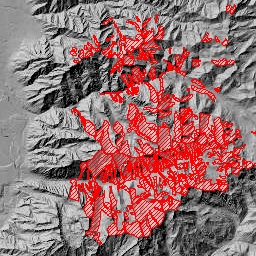
Avalanche Paths
- Category: Geoscience
- Data Type: GIS Data Layer
- Steward(s): AGRC
- Abstract: This dataset represents snow avalanche paths in the tri-canyon area of the Wasatch Front, Utah. This dataset contains the name, size of slidepath, return interval, starting zone elevation, vertical fall and starting zone aspect for some of the avalanches. This data was prepared for the Salt Lake County Wasatch Canyons Master Plan originally published in September 1989.
Avalanche Paths
Comments, questions, compliments, or concerns can be directed to the staff from AGRC at agrc@utah.gov or 801-538-3665.
Downloads and Web Services
Updates
- 2009