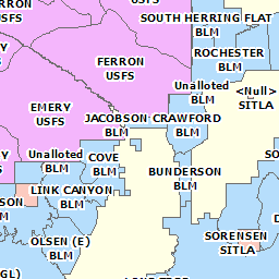
Grazing Improvement and Allotment Areas
- Category: Farming
- Data Type: GIS Data Layer
- Steward(s): USDA, UDAF, and AGRC
- Abstract: These datasets contain statewide Grazing Improvement Program and grazing allotment boundaries for use in planning and land management.
Grazing Improvement Areas

Grazing Improvement Regions contain statewide Grazing Improvement Program boundaries for use in planning and land management. Each region is managed by a Grazing Improvement Program coordinator.
Related Resources
There are no constraints or warranties with regard to the use of this dataset.
Downloads and Web Services
Updates
- September 2009
Grazing Allotment Areas

Grazing Allotments contain statewide Grazing Allotment boundaries for use in planning and land management. This dataset also contains the allotment name, number and managing agency.
Each allotment is managed by the listed state or federal agency on number of domestic animals allowed on the allotment and designated as Animal Unit Months (AUMs). The dataset was compiled by Utah Department of Agriculture and Food GIS staff from multiple state and federal agencies.
There are no constraints or warranties with regard to the use of this dataset.
Downloads and Web Services
Updates
- September 2009